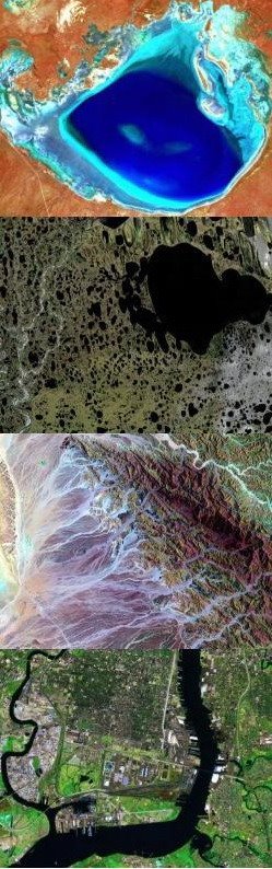
Landsat 7 and ETM+ Characteristics

Band Number Spectral Range(microns) Ground Resolution(m)
1 0.45 - 0.515 30
2 0.525 - 0.605 30
3 0.63 - 0.690 30
4 0.75 - 0.90 30
5 1.55 - 1.75 30
6 10.40 - 12.5 60
7 2.09 - 2.35 30
Pan 0.52 - 0.90 15


Swath width: 185 kilometers
Repeat coverage interval: 16 days (233 orbits)
Altitude: 705 kilometers
Quantization: Best 8 of 9 bits
On-board data storage: ~375 Gb (solid state)
Inclination: Sun-synchronous, 98.2 degrees
Equatorial crossing: Descending node; 10:00am +/- 15 min.
Launch vehicle: Delta II
Launch date: April 1999


References:
NASA, Supplying data users worldwide with low cost, multi-purpose, land remote sensing data into the next century

Scan Line Corrector Failure (SLC Off)

ETM+ Scan Line Correction Graphic

On May 31, 2003 the Scan Line Corrector (SLC) in the ETM+ instrument failed. The SLC consists of a pair of small mirrors that rotate about an axis in tandem with the motion of the main ETM+ scan mirror. The purpose of the SLC is to compensate for the forward motion (along-track) of the spacecraft so that the resulting scans are aligned parallel to each other. Without the effects of the SLC, the instrument images the Earth in a "zig-zag" fashion, resulting in some areas that are imaged twice and others that are not imaged at all. The net effect is that approximately one-fourth of the data in a Landsat 7 scene is missing when acquired without a functional SLC.

Following the SLC failure, an Anomaly Response Team (ART) was assembled, consisting of representatives from the USGS, NASA, and Hughes Santa Barbara Remote Sensing (the manufacturer of the ETM+ instrument). The team assembled a list of possible failure scenarios, most of which pointed at a mechanical problem with the SLC itself. Since there is no backup SLC, a mechanical failure would indicate that the problem was permanent. However, the team was unable to rule out the possibility of an electrical failure, though such a possibility was deemed remote. Nevertheless, on September 3, 2003, USGS director Charles G. Groat authorized the Landsat project to reconfigure the ETM+ instrument and various other subsystems on board Landsat 7 to use the spacecraft's redundant ("Side-B") electrical harness.

With this authorization, the USGS flight operations team at the NASA Goddard Space Flight Center uploaded a series of commands to the spacecraft, instructing it to operate using the redundant electrical harness. This operation was successful, and on September 5, 2003, the ETM+ instrument was turned on and acquired data that was sent to the Landsat ground system at EROS outside of Sioux Falls, South Dakota. It was immediately apparent that the migration to the Side-B electrical harness had not fixed the problem with the SLC. Following this, the instrument was reconfigured to use its primary electrical harness. The subsequent conclusion of the ART was that the SLC problem was mechanical and permament in nature.

Landsat 7 continues to acquire data in this mode. Data products are available with the missing data optionally filled in using other Landsat 7 data selected by the user. To continue the Landsat legacy, studies are underway to fly an equivalent scientific sensor on a new satellite towards the end of this decade.


References:
- Wikipedia, Landsat 7.
- NASA Landsat Handbook,
ETM+ Scan Line Corrector.

Major Benefits of Landsat 7

1. Mission Continuity: Landsat 7 is the latest in a long history of land remote sensing spacecraft, spanning 33 years of multispectral imaging of the Earth's surface, starting with the launch of Landsat 1 in 1972. In particular, the ETM+ continues the database of Earth imagery begun in 1982 by the Landsat 4 Thematic Mapper, providing the same spectral bands for consistent change detection.

2. Global Survey Mission: Landsat 7 data is acquired systematically to build and periodically refresh a global archive of sun-lit, substantially cloud-free images of the Earth's landmass. Approximately one quarter of the Earth's landmass is imaged every 16 days, using a planning scenario that emphasizes seasonal changes in vegetation and uses cloud predictions from NOAA to avoid imaging cloudy areas, thus optimizing the data acquisition strategy. If the data user wants a particular image, chances are that it is already in the data archive. Also, as environmental changes occur on the Earth's surface, it is highly probable that recent prior data already exists and can be quickly retrieved to compare with newly acquired data.

3. Affordable Data Products: Landsat 7 data products are available from the USGS Center for Earth Resources Observation and Science (EROS), Sioux Falls, South Dakota. These products are distributed at "the Cost of Fulfilling User Requests", known as the COFUR price. This is a significant price reduction from commercial data sales, allowing renewed use of Landsat data in academic institutions for scientific research. This has again stimulated the use of multispectral imagery in a variety of applications, fostering new uses not only for Landsat data but for other remote sensing data as well.

4. Absolute Calibration: Landsat 7 data from the ETM+ is calibrated to better than 5%, and serves as an on-orbit standard for cross-calibration of other Earth remote sensing missions. NASA orbited the EOS-AM1 spacecraft and EO-1 in formation with Landsat 7 to take advantage of this enhanced calibration.

These features, combined with all the traditional utility of Landsat data proven over 33 years, makes Landsat 7 data important for a wide and diverse remote sensing community.


References:
- NASA, Landsat 7.